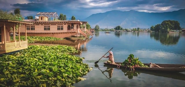
From 1954 until 2019, Jammu and Kashmir was a state in India; it is now a union territory administered by India. It has a population of more than 12 million people. It is located in the country’s northernmost region, bordering to the south by the states of Punjab and Himachal Pradesh, and to the west by Ladakh.
Srinagar is the largest and capital city in the Kashmir valley, with a population of 1.26 million people and an area of 242 km2, while Jammu is the capital city only during the winter season.
Note: In 2019, the government passed the Jammu and Kashmir Reorganization Act, transforming Jammu and Kashmir from a state into two union territories: Jammu and Kashmir in the west and Ladakh in the east.
| Rank | City Name | Population | Area (km²) | Density ( inhabitants/km²) | District |
|---|---|---|---|---|---|
| 1 | Srinagar (Srinagar) | 1,264,202 | 242.61 | 5,210 | Srinagar |
| 2 | Jammu | 657,314 | 201.59 | 3,260 | Jammu |
| 3 | Anantnag | 159,838 | 39.3 | 4,067 | Anantnag |
| 4 | Udhampur | 91,366 | 35.35 | 2,584 | Udhampur |
| 5 | Baramula (Baramulla) | 71,434 | 32.8 | 2,177 | Baramulla |
| 6 | Sopore | 71,292 | 28.7 | 2,484 | Baramulla |
| 7 | Kathua | 59,866 | 28.31 | 2,114 | Kathua |
| 8 | Bandipura (Bandipore) | 37,081 | 13.4 | 2,767 | Bandipora |
| 10 | Rajauri (Rajouri) | 29,486 | 12.89 | 2,287 | Rajouri |
| 11 | Ganderbal | 28,233 | 7.72 | 3,657 | Srinagar |
| 12 | Punch (Poonch) | 26,854 | 10.36 | 2,592 | Poonch |
| 13 | Kulgam | 23,584 | 12.8 | 1,842 | Kulgam |
| 14 | Duru Verinag | 22,968 | 12.3 | 1,867 | Anantnag |
| 15 | Bijbiara (Bijbehara) | 22,789 | 2.4 | 9,495 | Anantnag |
| 16 | Kupwara | 21,771 | 4.1 | 5,310 | Kupwara |
| 17 | Doda | 21,605 | 14.25 | 1,516 | Doda |
| 18 | Akhnoor | 20,756 | 11,219 | 11,219 | Jammu |
Facts about largest cities of Jammu and Kashmir :
- Srinagar: Known as the “Paradise on Earth” for its beautiful gardens and lakes.
- Jammu: Famous for its historic temples and the Mubarak Mandi Palace.
- Anantnag: Renowned for its scenic beauty and the Martand Sun Temple.
- Baramulla: Known for its ancient shrines and the Baramulla Fort.
- Udhampur: A rapidly developing city with a growing industrial sector.
- Kathua: Famous for its apple orchards and the Jasrota Fort.
- Pulwama: Known for its saffron fields and the Pulwama Fort.
- Rajouri: A picturesque town with a rich cultural heritage.
- Samba: Known for its historical sites and the Samba Fort.
- Reasi: Famous for its ancient temples and the Shiv Khori Cave Shrine.

