Districts are administrative subdivisions of the Indian states, headed by officers called Deputy Commissioners (DCs) or District Magistrates (DMs). These officers are responsible for implementing the policies of the government, maintaining law and order, and coordinating developmental activities within their jurisdictions. A large number of departments of the government function within the districts. These include education, health, infrastructure, agriculture, and public welfare, which provide efficient governance and public service delivery.
India is one of the largest and second most populous counties in the world, situated over a vast area of 3.287 million square kilometers. To streamline this big land, 28 states and 8 Union Territories govern the country, making up more than 800 districts out of them.
Gujarat’s Kachchh – the biggest district in the country. Kachchh is a vast geographically unique area of 45,652 square kilometers having salt marshes, arid landscapes, and an internationally famous seasonal salt march called the Rann of Kutch, which attracts tourists, as well as wildlife enthusiasts to the region.
The following are the biggest districts in terms of total area.
| Rank | District | State | Area(sq.km) | Area(sq.mile) |
|---|---|---|---|---|
| 1 | Kachchh | Gujarat | 45,110 | 17626 |
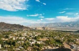
| 2 | Leh | Jammu and Kashmir | 45,110 | 17417 |
| 3 | Jaisalmer | Rajasthan | 38401 | 15179 |
| 4 | Bikaner | Rajasthan | 30,247 | 10991 |
| 5 | Barmer | Rajasthan | 28,393 | 10963 |
| 6 | Jodhpur | Rajasthan | 22,901 | 8842 |
| 7 | Anantapur | Andhra Pradesh | 19,130 | 7386 |
| 8 | Mahbubnagar | Andhra Pradesh | 18,432 | 7117 |
| 9 | Nagaur | Rajasthan | 17,686 | 6829 |
| 10 | Kurnool | Andhra Pradesh | 17,658 | 6818 |
Kuchchh district is marked with a red dot on the border in the map.


